The following is a greeting given in one of the 20 indigenous languages recognized by the State of Alaska.
- Ade’ ndadz dengit’a?
- Language: Deg Xinag
- Translation: "Hello, how are you?"
Natural Hot Springs
Natural Hot Springs
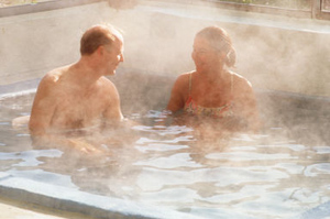
Early miners and trappers were quick to use the naturally occurring warm waters for baths. Today approximately 25 percent of the recorded thermal springs are used for bathing, irrigation or domestic use. Only a handful of the known hot springs can be considered developed and these are found in Southeast, Interior and the Western Alaska regions. Facilities can range from full resorts to simple changing shacks at crude dams to create sitting pools. Southeast Hot Springs Hot springs are scattered throughout Southeast Alaska. The soothing springs often are a destination for wilderness travelers but in many cases, they are simply an added treat. The town of Tenakee Springs actually grew up around the hot springs which are still a major attraction for this community. Following are a few of the springs found in Southeast Alaska. Baranof Warm Springs. Located 20 miles cast of Sitka on the east shore of Bararnof Island. A private hot springs bath is located on Warm Springs Bay (status unknown). Accessible by boat or floatplane. A Forest Service trail extends a half mile from the hot springs to Baranof Lake where a cabin is located. Cabin access is by floatpIane. It is riot possible to hike from the springs to the cabin. Chief Shakes Hot Springs. Located off Ketili River, a slough of the Stikine River, approxirnately 12 miles upriver. The Hot Springs Slough Route is one of several established Canoe/Kayak Routes along the Stikine. Two hot tubs, 1 enclosed in a screened structure, provide a good place to soak. The open-air tub has a wooden deck around it, and both tubs have changing area. There are also a picnic table, fire ring, and an outdoor privy. The area is used heavily in the evenings and weekends, according to the Forest Service. Paddlers should also be aware that use of the Stikine and the slough by powerboats is especially high during evenings and weekends. The Forest Service maintains 2 cabins just upriver. Goddard Hot Springs. Located on the outer coast of Baranof Island on Hot Springs Bay off of Sitka Sound, 16 miles south of Sitka. This may have been the earliest Alaska mineral springs known to the Europeans and before their arrival Indians came from many miles away to benefit from the healing waters. In the rnid-1800s there were 3 cottages at Goddard that were used to house invalids from Sitka. In the late 1880s, a Sitka company erected frame buildings for the use of people seeking the water's benefits. By the 1920s a 3-story hotel was built to provide more sophisticated accommodations. The building was purchased in 1939 by the Territorial Legislature as an overflow home for the Sitka Pioneers' Home. After 1946 the building fell into disuse and was torn down. Today, the city of Sitka owns the property and maintains 2 modern cedar bathhouses for recreational use. A few people live year-round on nearby private land. There are open shelters over the hot tubs, which feature natural hot springs water and cold water. The springs are very popular with area residents. The area has outhouses. Boardwalks provide easy walking. Boaters can anchor in the bay and go ashore in skiffs. This is riot a place to take a boat without a chart; there are lots of rocks and shoals, especially around the hot springs. There are protected routes to Sitka and a fascinating series of coves and channels just north of the hot springs. At the springs there are campsites in a grassy meadowlike area and on higher ground. Biting black flies (whitesox) are plentiful in the summer months. Shelokum Hot Springs. Located approximately, 90 miles north of Ketchikan in the Tongass National Forest on the Cleveland Peninsula. A 2.2-mile trail begins at Bailey Bay just south of Shelokum Creek and leads to Lake Shelokum. At the inlet to the lake is a 3-sided shelter. The hot springs are completely undisturbed and support a healthy population of unique algal plant life. Trocadero Soda Springs. This seldom-visited carbonated "soda" springs is located on the west coast of Prince of Wales Island about 12 miles southeast of Craig. Access is by boat. Rubber boots are advised for this hike. This is bear country; exercise caution, particularly when salmon are spawning. The springs are reached by walking up a nameless creek that has its outlet in a small inlet on the south shore of the bay. The springs flow into the creek about a mile upstream. The first sign of the springs are 2 giant golden steps. These are banks of yellow tufa formed by the constant runoff from the springs. Tufa is a geological term referring to a concretionary sediment of silica or calcium carbonate deposited near the mouth of a mineral spring or geyser. The 4- to 5acre area around the bubbling, hissing springs features lunar like mounds and craters, splashed with colors ranging from subtle yellow to iron red. The springs originate in muskeg, then the mineralized water meanders about 100 feet, forming a deep crust of tufa in which there are hundreds of small vents with escaping gas and bubbling water. The highly carbonated water is described as having "a sharp, pleasant taste" and has no unpleasant odors. Although water from other carbonated springs in Southeast has been bottled and sold in the past, Trocadero water has never been commercially marketed. White Sulphur Hot Springs. Located within the West Chichagof-Yakobi Wilderness area, some 65 miles northwest of Sitka. Many visitors fly in to a small lake nearby and hike to the cabin or boat to Mirror Harbor and walk the easy, year-round 0.8mile trail to the hot springs. Various log bathhouses have been built over the principal springs and in earlier years occasional hunters and trappers camped here. At that time the pools were called Hoonah Warm Springs, but years ago they were renamed for a dentist, Dr. White. In 1916 the U.S. Forest Service built its first cabin and bathhouse here. This cabin has been modernized in recent years so bathers can pull back a translucent fiberglass screen and admire the view of the often turbulent Pacific Ocean while soaking in the hot water. This is a popular bathing spot for commercial fishing and charter boat guests, and a destination for kayakers (primarily paddling from Pelican). Western Hot Springs Pilgrim Hot Springs. Located on the left hank of the Pilgrim River 13 miles northeast of Salmon Lake. This site of a gold rush resort and later a Catholic mission is listed on the National Register of Historic Places. In the days of gold mining on the Seward Peninsula about 1900, the property was known as Kruszgamepa Hot Springs arid was recreation center for miners attracted by its spa baths, saloon, dance hall and roadhouse. The roadhouse and saloon burned in 1908. The property was given to Father Bellarmine Lafortune, who turned the ranch into a mission and orphanage in 1917-18 and operated it until 1941, housing up to 120 children. Ruins of the mission school and other church properties remain at the site, which is still owned by the Catholic Church. Access is by charter air service from Nome to a small airfield at Pilgrim Hot Springs, or by car on an 8-mile gravel road that joins the Nome-Taylor Road at Cottonwood. Serpentine Hot Springs. Located within Bering Land Bridge National Preserve. The waters of Serpentine Hot Springs have long been sought for their healthful properties. Eskimo shamans gathered here in earlier times. When the influence of the shamans had passed, Native healers still relied on these waters to help their followers. Likely the most visited area of Bering Land Bridge National Preserve, Serpentine still offers a soothing break from the harsh surrounding climate, and the nearby granite tors create a dramatic landscape that lures hikers to explore. A public-use cabin is located at the springs. Winter trails from Shishmaref and other traditional villages lead to Hot Springs Creek near the tractor trail. Traverse by snow machine and dogsled in winter reaches the springs from the end of the Nome-Taylor (Kougarok) Road. A 1,100-foot airstrip at the hot springs allows wheeled plane access. Interior Hot Springs Chena Hot Springs: Located about 50 air miles northeast of Fairbanks, this popular private resort can be reach via the Steese Highway and the Chena Hot Springs Road. The road cuts through Chena Rivers State Recreation Area, an exceptional area offering picnic sites, campgrounds and easy access to the Chena River's grayling fishery (catch-and-release only). Chena Hot Springs were first reported in 1907 by U.S. Geological Survey field teams. The resort offers food, lodging and swimming in the mineral springs; phone (907) 452-7867. There is also an airstrip at the lodge. Overnight camping is available for a fee in the parking area at the end of the road. Circle Hot Springs: About 100 miles northeast of Fairbanks, the springs are 8 miles off Mile 127.8 Steese Highway. Ketchum Creek BLM Campground is located at Mile 5.7 of the Circle Hot Springs Road, offering 12 campsites with toilets, tables and firepits. At the hot springs, year-round swimming, lodging, food, groceries, bakery, gas and camper parking are available; phone (907) 520-5113. Circle Hot Springs was discovered in 1893 by prospector William Greats. In 1905, Franklin Leach homesteaded around the springs. Tents were used as the first bathhouses. Many miners wintered over tat the springs when they could not work on the creeks. The springs provide warm water for irrigating the resort's garden, which produces vegetables of great variety and size. Many buildings have been extensively renovated. Manley Hot Springs: Located 151 miles from Fairbanks via the Elliott Highway, the springs are on a hillside just outside the community of the same name. One spring runs 35 gallons a minute with a temperature of 136 degrees farhenheit, another runs 110 gallons per minute at 135 degrees fahrenheit, for a total of some 208,800 gallons every 24 hours. Manley Hot Springs Resort ((907) 672-3611) offers good, lodge, camping and swimming in a hot mineral spring-fed pool. The resort is open year-round. Melozi Hot Springs: Located on Hot Springs Creek, 30 miles northeast of Ruby. There is a group of 20 or so springs along the creek. A 1911 U.S. Geological Survey team reported finding a 2-room cabin and 2 small bathhouses on the springs. Today, Melozi Hot Springs is the site of a private fly-in wilderness lodge; phone (907) 892-6987. |
Alaska Facts
State Nick Name: "The Last Frontier" - the name Alaska is derived from the Aleut word "Alyeska," meaning "great land."
State Motto: "North to the Future"
State Capital: Juneau, located in the Southeast region of Alaska, has a population of 33,277 (2015 Estimate of Population, Alaska Department of Labor and Workforce Development)
Alaska Map:

Alaska Flag:

NOTE: The State of Alaska is not responsible for the content/information on any site outside of a State of Alaska department.

